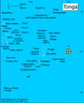
Tonga
Facts & Figures

-
Sovereign: Tupou VI (2012)
Prime Minister: ʻAkilisi Pohiva (2014)
Land area: 277 sq mi (717 sq km); total area: 289 sq mi (748 sq km)
Population (2014 est.): 106,440 (growth rate: 0.09%); birth rate: 23.55/1000; infant mortality rate: 12.36/1000; life expectancy: 75.82; density per sq mi: 360
Capital and largest city (2011 est.): Nuku'alofa, 25,000
Monetary unit: Pa'anga
Languages: English and Tongan 87%, Tongan (official) 10.7%, English (official) 1.2%, other 1.1%, uspecified 0.03%
Ethnicity/race: Tongan 96.6%, part-Tongan 1.7%, other 1.7%, unspecified 0.03%
Religion: Protestant 64.9% (includes Free Wesleyan Church 37.3%, Free Church of Tonga 11.4%, Church of Tonga 7.2%, Tokaikolo Christian Church 2.6%, Assembly of God 2.3% Seventh Day Adventist 2.2%, Constitutional Church of Tonga .9%, Anglican .8% and Full Gospel Church .2%), Mormon 16.8%, Roman Catholic 15.6%, other 1.1%, none 0.03%, unspecified 1.7%
Literacy rate: 99% (2006 est.)
Economic summary: GDP/PPP (2013 est.): $846 million; per capita $8,200. Real growth rate: 1%. Inflation: 2%. Unemployment: 13% (FY03/04 est.). Arable land: 21.33%. Agriculture: squash, coconuts, copra, bananas, vanilla beans, cocoa, coffee, ginger, black pepper; fish. Labor force: 39,960 (2007); agriculture 31.8%, industry and services 30.6% (2003 est.). Industries: tourism, construction, fishing. Natural resources: fish, fertile soil. Exports: $9.1 million (2013 est.): squash, fish, vanilla beans, root crops. Imports: $122.5 million (2013 est.): foodstuffs, machinery and transport equipment, fuels, chemicals. Major trading partners: Japan, China, U.S., Taiwan, New Zealand, Fiji, Australia, American Samoa, Samoa, South Korea, Hong Kong, Brazil (2011).
Member of Commonwealth of Nations
Communications: Telephones: main lines in use: 30,000 (2012); mobile cellular: 56,000 (2012). Radio broadcast stations: 2 state-owned TV stations and 2 privately-owned TV stations; satellite and cable TV services are available; 2 state-owned and 3 privately-owned radio stations; Radio Australia broadcasts available satellite (2009). Radios: 61,000 (1997). Television broadcast stations: 2 (2001). Televisions: 2,000 (1997). Internet Service Providers (ISPs): 5,367 (2012). Internet users: 8,400 (2009).
Transportation: Railways: 0 km. Highways: total: 680 km; paved: 184 km; unpaved: 496 km (2011 est.). Ports and harbors: Neiafu, Nuku'alofa, Pangai. Airports: 6 (2013).
International disputes: none.

