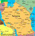
Tanzania
Facts & Figures
-
President: John Magufuli (2015)
Prime Minister: Mizengo Pinda (2008)
Land area: 342,100 sq mi (886,039 sq km); total area: 364,898 sq mi (945,087 sq km)1
Population (2014 est.): 49,639,138 (growth rate: 2.8%); birth rate: 36.82/1000; infant mortality rate: 43.74/1000; life expectancy: 61.24; density per sq mi: 123.1
Capital (2011 est.): Dodoma, 410,956 (meeting place of the National Assembly since 1996); the executive branch offices and diplomatic representation are housed in Dar es Salaam, 3.588 million
Monetary unit: Tanzanian shilling
Languages: Swahili, English (both official); Arabic; many local languages
Ethnicity/race: mainland: native African 99% (includes 95% Bantu, consisting of more than 130 tribes), Asian, European, and Arab 1%; Zanzibar: Arab, native African, mixed
Religions: mainland: Christian 30%, Islam 35%, indigenous 35%; Zanzibar: more than 99% Islam
Literacy rate: 67.8% (2010 est.)
Economic summary: GDP/PPP (2013 est.): $79.29 billion; per capita $1,700. Real growth rate: 7%. Inflation: 7.8%. Unemployment: n.a. Arable land: 12.25%. Agriculture: coffee, sisal, tea, cotton, pyrethrum (insecticide made from chrysanthemums), cashew nuts, tobacco, cloves, corn, wheat, cassava (tapioca), bananas, fruits, vegetables; cattle, sheep, goats. Labor force (2013 est.): 25.59 million; agriculture 80%, industry and services 20%. Industries: agricultural processing (sugar, beer, cigarettes, sisal twine); mining (diamonds, gold, and iron), salt, soda ash; cement, oil refining, shoes, apparel, wood products, fertilizer. Natural resources: hydropower, tin, phosphates, iron ore, coal, diamonds, gemstones, gold, natural gas, nickel. Exports: $5.92 billion (2013 est.): gold, coffee, cashew nuts, manufactures, cotton. Imports: $11.16 billion (2013 est.): consumer goods, machinery and transportation equipment, industrial raw materials, crude oil. Major trading partners: India, Japan, China, Kenya, South Africa, UAE, Germany (2012).
Member of Commonwealth of Nations
Communications: Telephones: main lines in use: 161,100 (2011); mobile cellular: 27.22 million (2012). Radio broadcast stations: a state-owned TV station and multiple privately-owned TV stations; state-owned national radio station supplemented by more than 40 privately-owned radio stations; transmissions of several international broadcasters are available (2007). Radios: 8.8 million (1997). Television broadcast stations: 3 (1999). Televisions: 103,000 (1997). Internet Service Providers (ISPs): 26,074 (2012). Internet users: 678,000 (2009).
Transportation: Railways: total: 3,689 km (2008). Highways: total: 86,472 km; paved: 7,092 km; unpaved: 79,380 km (2010 est.). Waterways: Lake Tanganyika, Lake Victoria, Lake Nyasa. Ports and harbors: Bukoba, Dar es Salaam, Kigoma, Kilwa Masoko, Lindi, Mtwara, Mwanza, Pangani, Tanga, Wete, Zanzibar. Airports: 166 (2013).
International disputes: Dispute with Tanzania over the boundary in Lake Nyasa (Lake Malawi) and the meandering Songwe River; Malawi contends that the entire lake up to the Tanzanian shoreline is its territory, while Tanzania claims the border is in the center of the lake; the conflict was reignited in 2012 when Malawi awarded a license to a British company for oil exploration in the lake.
